A $600,000 Australian and U.S. research project has pioneered ground-breaking techniques to map Australian landscapes through a veil of heavy cloud and smoke.
Scientists from six Australian research organisations and NASA have just concluded a massive field and airborne data collection mission of multiple sites in Queensland and the Northern Territory.
The mission covered 35,000 square kilometres of land and sea in Moreton Bay, Daintree-Cooktown and the Darwin-Mary River regions.
It involved 13 scientists with satellite/airborne radar and on-ground field monitoring expertise.
They are from:
- The University of Queensland,
- Northern Territory University,
-Griffith University,
-the CSIRO Division of Land and Water,
-Australian Cooperative Research Centres ( Rainforest and Coastal Zones), and
-NASA'sJet Propulsion Laboratory.
According to one of the project leaders Dr Stuart Phinn (UQ) project data will answer key questions asked by government and other agencies, such as the extent, biomass and condition of tropical rainforests, wetlands and savannas in Australia and around the world.
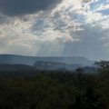
"The major stumbling block to mapping and monitoring these environments from aerial photographs and satellites is that they are usually covered in cloud or smoke from fires," he said.
"Our project is producing accurate maps of canopy and ground terrain, forest height, biomass and the presence of flooding beneath forests.
"It integrates radar imaging systems with traditional satellite images to provide all-weather monitoring capabilities."
Dr Phinn said the field campaign collected ground information (including vegetation height, density, biomass and presence of flooding) to verify the images collected from a radar imaging system,
"Image data were collected from the AirSAR imaging radar system on NASA's DC-8 Airborne Science Platform, as well as several Australian airborne sensors," he said.
"The AirSAR instrument is a form of radar able to penetrate clouds and smoke, making it ideal for collecting information from cloudy and smoky tropical environments where it's impossible to operate aerial photography or traditional satellite imaging systems. "
Dr Phinn said the project was the first to develop and deliver an accurate and effective all-weather tool for mapping environmental conditions and their changes to Australian monitoring and management agencies.
The work addresses the monitoring requirements of Queensland's Wet Tropics Management Authority and the Northern Territory Department of Lands, Planning and Environment.
The three-year project is funded by the Australian Research Council, Rainforest CRC, Northern Territory University and The University of Queensland.
Photo ftp site: http://photos.cc.uq.edu.au/PNF:byName:/ScienceWriters/
Pic captions:
o Airsar.jpg = NASA's DC-8 Airborne Science Platform with the AirSAR Antennae mounted on the left side of the fuselage at the rear. Image courtesy of NASAJPL.
o canopy.jpg: UQ/CRC-Rainforest researchers Peter Scarth and Michael Stanford collecting canopy level samples from the canopy crane at Cape Tribulation as part of field validation exercises. Image courtesy of A.Held,CSIRO.
o Phinn SAR_image.jpg: AirSAR multiband composite of the Lake Coombabah region, south east Queensland acquired during in PACRIM1 in 1996.
o 068.jpg Dr Stuart Phinn
Media: For further information, contact Dr Stuart Phinn, Biophysical Remote Sensing Group, Department of Geographical Sciences and Planning, The University of Queensland, telephone 07 3365-6526, Mobile: 0417-629765, email: s.phinn@mailbox.uq.edu.au or email: communications@mailbox.uq.edu.au
.jpg)


